Jesse Carnes has spent a lot of miles on the trails, both on foot and bike. He is currently training for his first 100 mile footrace, IMTUF. You can read more about Jesse’s exploits here.
Let me start by saying, like many people who enjoy rambling around in the woods, I really like maps. Perusing over a good map gives a sense of excitement and possibility. There’s nothing quite like spreading out a map on the living room floor and plotting out possible excursions. Do you think we can traverse that ridgeline? I wonder if we can get down to that lake without getting cliffed out? That trail connects there?! No way! We can make a great loop out of that.
I got my start reading maps by reading USGS quad maps on family backpacking trips. These set a high bar for technical accuracy, but a very low bar for graphic appeal. During the summers when I was in college, I worked for the Forest Service and continued reading those same quad maps, while also occasionally using the National Forest map for the area. The difference was striking. The forest map was substantially easier to look at, but was occasionally lacking in technical accuracy or detail. These differences can be found on all sorts of maps, and they are worth paying attention to.
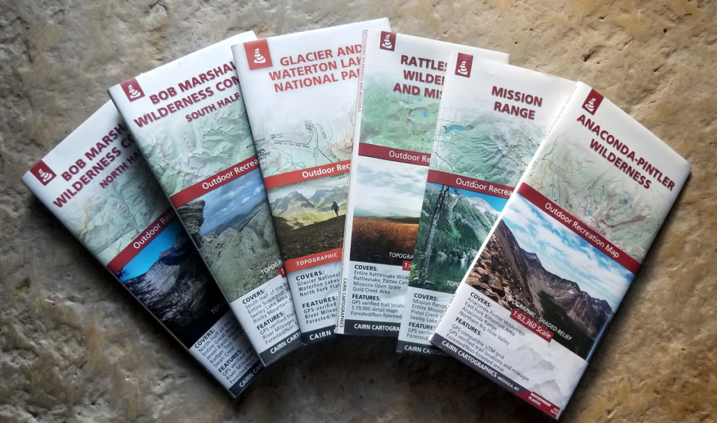
In the last few years, the maps produced by Cairn Cartographics have become by far my favorite maps to use in the state of Montana. Generally, in my product reviews, I like to point out the things I do and don’t like about the product in question, but the only negative thing I can say about the Cairn maps is that I wish there were more of them. As a result, I am just going to tell you why they are the best maps of the area.
Visual Presentation
When I compare these maps to the majority of other maps of the region, one of the first things I notice is how easy it is to interpret the landscape. A big reason for this is an effective use of shading in addition to topo lines, allowing you to not only read the slope based on density of lines, but to get an immediate overall sense of the landscape, as if you were actually looking at it from above.
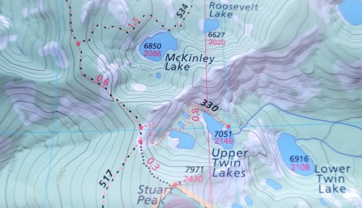
In addition, it is important to note that the text is chosen very deliberately, so as not to get in the way if it’s not what you’re looking for, but to be easy to read if it is. I have used countless maps through the years that have text all over the place, which interferes with one’s ability to get the aforementioned lay of the land.
Lastly, the key is fairly intuitive. The delineation of trails for different user groups is easy to figure out, and the land ownership classifications are, for the most part, pretty clear. As you can see above, there are also different colors used for forested areas and those either above tree-line or otherwise unforested. This has proved very useful when determining whether a proposed ridge route is going to involve a lot of bushwhacking or not.
Accuracy/Detail
One might think, in this day and age of easy-to-use GPS devices, that the accuracy of maps can be taken without question. In general, it is true that most are pretty darn good, but I still run into the occasional situation where the map says there is a trail that doesn’t actually exist, or the trail goes off in a different direction, or the lake that allegedly exists is only there part of the year. Likely because of their specific focus on places that are close to their own backyard, Cairn Cartographics seems to catch most of this stuff. It is worth noting that over time, new trails, closures, and general changes in landscape will yield some inaccuracies, but at the time of production, my impression is that these maps are extremely accurate.
Materials
Printed on a tear-resistant plastic, these maps are extremely durable and waterproof. As much as I appreciate the nostalgia of a quad map folded up in a ziploc bag, with the area you need to see facing up, it sure it nice to have something you can open up in the rain without ruining it. Every map should be waterproof, but not every map is.
Also worth noting is the size of the maps. The total size is 25″ x 39″, which is fairly manageable. While I do love laying out a good 36″ x 48″ forest map in the house, those get pretty unwieldy in the backcountry.
They’re local!
Cairn maps are made by a local couple in Missoula, Amelia Hagen-Dillon and Jamie Robertson. They have been producing them since 2010 and are an integral part of the local outdoor scene. Additionally, Amelia is one of the new Runners Edge ambassadors, so watch for some of her product reviews coming out soon!

As I mentioned, my biggest complaint about Cairn Cartographics is that I wish there were more maps! Eventually, I would really like to see a map of the Great Burn/Stateline trail area, as well as a detailed map of the three mountain biking areas close to Missoula (Blue Mountain, Pattee Canyon, Rattlesnake). While poking around on their website, I was excited to learn that they have a Public Lands of Montana wall map, which is definitely now on my list to get when I get the chance.
Check ’em out, and start planning your next adventure!